Monday, May 25, 2009

Propaganda Map


Propaganda maps are used mainly during a propaganda. These maps are used to identify different land regions, more particularly in a time and place of war. This propaganda map shows the developments of early French development. These types of maps show dangerous regions, or military actions.
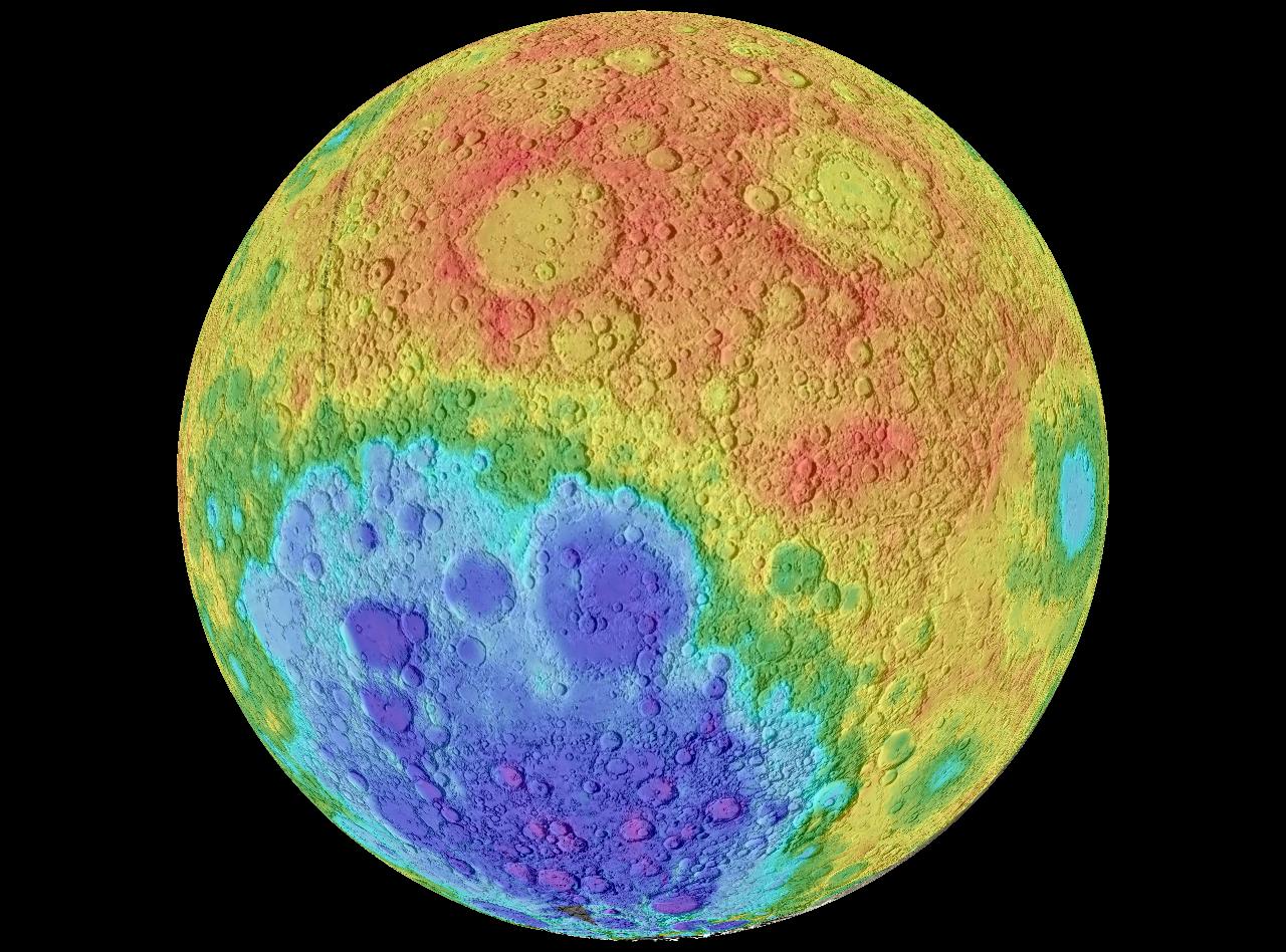
Hypsometric Map


This is an example of a hypsometric map. This shows the moons different geographic structures. A hyposemtric map is generally used to show different dimensions using shading and tinting.

Map found at: http://upload.wikimedia.org/wikipedia/commons/3/3b/Moon_worldwind.jpg

PLSS Map


PLSS is an abbreviation for Public Land Survey System, that shows images that are divided and owned by the government. These maps are used to show an area of township. These maps are also used to identify land parcels, titles, and deeds of rural land. This specific map shows the Western area of the United States specific parcels.


Map Found at: http://gis.nwcg.gov/giss_2006/job_aids/maps_and_graphics/USA_PLSS_Meridians_map.jpg

Cadastral Map

This is an example of an cadastral map. Cadastral maps are used to show ownership of properties. This type of map shows precise locations, and dimensions of individual parcels of land. Cadastral maps are used by many nations around the world, and some also include GPS coordinates. This particular cadastral map is of a neighborhood.
Map found at:

Thematic Map


This is an example of a thematic map. Thematic maps are used to reflect a particular theme about an area. Thematic maps can show, social, political, cultural, sociological, agricultural, education, economic details or any other aspects of an area, city, state, county, country or continent. This thematic map is showing the theme of population change in the United States, by the Bureau of the Census.

This map was found at:

Topographic map

This is an image of a topographic map; which is a type of map that represents natural and man-made landmarks. This is a topographic map that uses contour lines. This topographic map uses a large scale that is typically used in topographic maps, all though topographic maps can be used for a smaller scale.
https://www1.nga.mil/ProductsServices/TopographicalTerrestrial/PublishingImages/350px-Topographic_map_example.png

Tuesday, May 19, 2009

Planimetric map

This is a Planimetric map. This type of map shows only horizontil positions; and it does not show verticle information. This map show sthe area of Lake George. This map shows street signs and specific places such as the Lake George Beach State Park. Notice that the map shows no heights, nor verticle dimension.

Friday, May 15, 2009

Mental Maps


This is a mental map. This map is made strictly for the user to understand; and appears to be hand drawn in a short time period. There are no keys, nor does this map show significant details. It seems as though this map is illustrating a town or village's center, but only the author of this map would truly know.