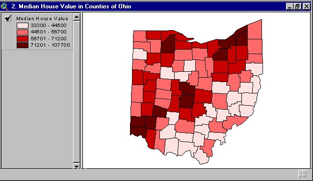
 Here is an example of a bivariate choropleth map. This type of map is thematic, showing several different types of data; for example this map shows 4 different price ranges of housing in Ohio.
Monday, August 3, 2009
Bivariate choropleth maps
Here is an example of a bivariate choropleth map. This type of map is thematic, showing several different types of data; for example this map shows 4 different price ranges of housing in Ohio.
Unclassed choropleth maps

This is an unclassed choropleth map that shows fertility rates. An unclassed choropleth map using shadings to represent the data.
Image found at: http://www.esds.ac.uk/international/images/uchoropleth.gif
Saturday, August 1, 2009
Classed choropleth maps

Here is an image of a classed choropleth map. This choropleth map shows the amount spent in millions in overseas residents in Great Britian. These types of maps need to include a histogram and shading.
DEM

A Digital Elevation Model (DEM) shows raised geographic data. The DEM above shows the elevations of Lake Tahoe. DEMs are used in xyz coordinates, and use contour lines.
Image found at: http://tahoe.usgs.gov/images/4ds/dem_dlg.gif
DRG
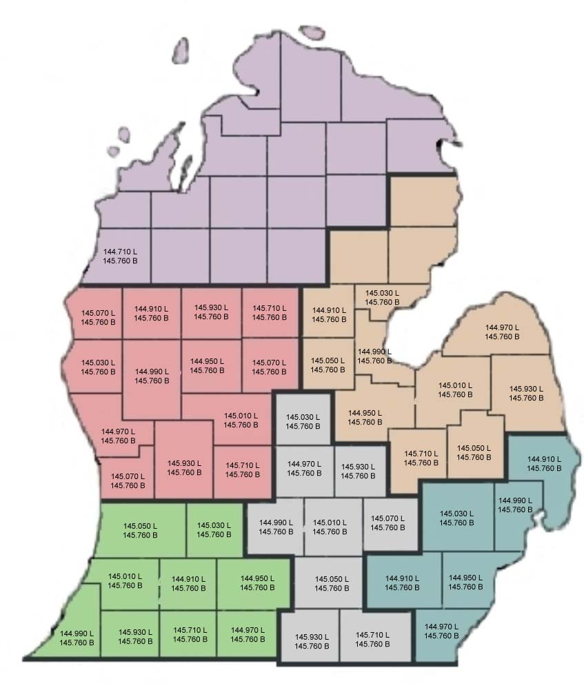
Here is an example of a digital raster graphic (DRG). This is a type of topographic map. DRG are used to collect, review and revise digital data.
Image found at: http://www.mi-drg.org/DRG-Freq-example.jpg
Friday, July 31, 2009
Isopach
 Here is an image of Isopach lines. This one shows sandstone quality created from well logs. Isopaches are used to elevations and differences in height. The pink area shows that the sandstone is about 45ft thick, and the green is 25 ft thick.
Image found at: http://www.cartage.org.lb/en/themes/Sciences/Earthscience/Geology/OilandGas/HydrocarbonExploration/GeologicMaps/SANDSTONE_MAP.jpg
Isohyets
 Isohyets are another type of contour line. This image of Isohyets is showing the amount of rainfall in Tasmania. This shows lines of precipitations and rainfall.
Image found at: http://soer.justice.tas.gov.au/2003/image/265/water%20quantity/m-ilw_quantity_rainfall-l.gif
Subscribe to:
Posts (Atom)
