A Geography Information System (GIS) is a computer-based system made to display material referenced to the environment. GIS can be used for site remediation, natural resources management, groundwater modeling, vegetation mapping and more. GIS can also show different layers of data, as the one above is showing layers of monitoring wells, industries and population.
Monday, August 3, 2009
State Plane Coordinate System
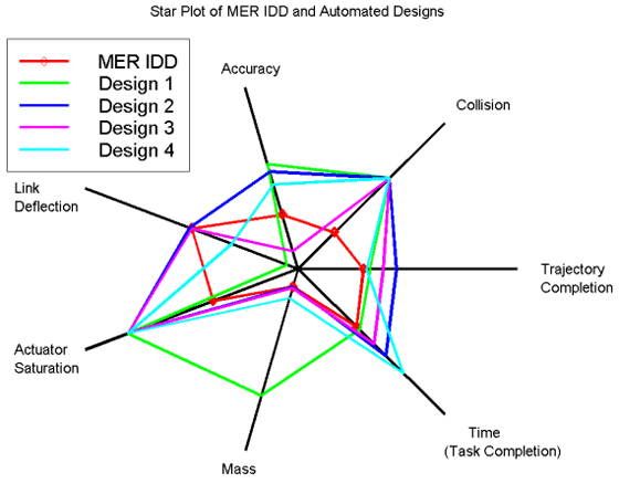
Star plots
Star plots are used to graph all sorts of data that are relative to the same behavior of all variables in a multivariate data set. Star plots are created with "spokes" and each spoke has represents a different data. With all of the interconnecting spokes the chart looks like a start hinse the name "star plot."
Correlation matrix
Similarity matrix
Here is an example of a similarity matrix. This type of graph shows similarity between two different types of data. All though they are not easy to read, they are good to use when compairing data. High scores are for similar data, and low scores are for more different data.
Image found at: http://cgi.mtc.sri.com/Cluster-Lab/01.jpg
Stem and Leaf Plot
Stem and Leaf plots are used to organized numerical data. If this plot represented students in a class over the past 5 years the plot would read 22; 26;27;31;33;35 etc.
This type of plots is a good way to help children learn mathmatical problems. Image found at: http://www.highpointsmath.com/sitemap/images/clip_image004_017.jpg
Box plot
Another type of statistical graph is a Box Plot. Box plots provide a simple graphical summary of a set of data. Box plots can handle large data sets, but do not share an exact retained value.
Image found at: http://math.youngzones.org/boxplot.gif
Subscribe to:
Posts (Atom)